HISTORICAL NAUTICAL INSTRUMENTS
The first records of boats large enough to carry trading goods are from between 3500 BC to 3000 BC, so we can safely assume that that time also marked the beginning of navigation. These first navigators had no choice but stay close to shore and navigate by sight of landmarks or other characteristics on land that they could see. They travelled mostly by day and went for a safe harbor to stay at anchor at night. They did however develop kind of rudimentary charts, which listed directions, showed crude drawings depicting landmarks and certain dangerous places like reefs, sandbanks or rocks in the water. Early documents state that the more experienced mariners of the time were said to plot their course by using certain star constellations so most vessels followed the east/west movement of the sun or the track of the stars.
However, the ancient navigator had no way to accurately determine longitude and therefore, once out of sight of land, had no idea how far east or west he was. So his estimates were made based upon the time it took to sail from A to B. This is the simplest form of navigation and it is called dead-reckoning; it is still used by navigators today. To determine the distance travelled from one point to another, the navigator would multiply the time he sailed by the speed of the vessel. Of course these crude calculations were often way off because time was still measured with a sandglass and speed was estimated by watching pieces of seaweed or wood pass by the hull.
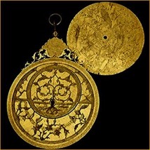
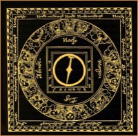
Persian Astrolabe 1660 - The astrolabe represents a mathematical likeness of the heavens and its Greek name is - "Star Taker". This amazing sophisticated scientific instrument has been crafted by Muhammad Mahdi al-Khadim al-Yazdi in brass and was used to solve astronomical problems and to show the positions of stars and planets at different dates, times and latitudes. The Persian calligraphy engraving reads a quotation from the Koran: "The world is decorated with stars".
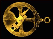
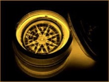
Spanish/Portuguese Astrolabe 1588 - The mariner's astrolabe has been developed by Arabic astronomers. Christopho Columbo used a similar astrolab design on his voyages to discover the "New World". It was a simplified version of an instrument for measuring the height of stars and the sun above the horizon level. This astrolabe has been discovered in southern Ireland were several ships of the Spanish Armada foundered.
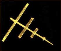
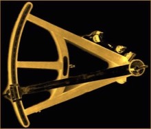
Cross Staff circa 1700 - This particular Cross-Staff has been crafted by Thomas Tuttell, London, circa 1700.
The cross-staff was another instrument designed to measure the altitude of the sun or polar star. It made use of the properties of right-angled triangles, or trigonometry. The navigator or captain rested the main staff just below his eye and moved the cross until the bottom was aligned with the horizon level, and the top with the lower edge of star or sun. The position could then be read off on the scale in degrees and minutes. Cross-staves were mostly made of wood, but there are indications that some have been crafted in metall (brass) as well. Constantly looking at the sun with an instrument of this kind has often caused blindness.

1750
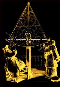
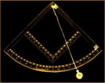
Gigantic Astronomical Sextant - Astronomical sextants had been in use since the 16th century.